Goosenecks is located on a mesa above the meandering San Juan River. The river is over 1000 feet below the mesa and it is a wonderful view.
This time we chose a site away from the edge of the mesa as we knew about the strong winds that could come through the area. Last time we thought we were going to get blown over the edge!
After we set up camp, we drove down to the town of Mexican Hat which is named for this formation which is north of town.
We picked up some geocaches along the way. This is a different side of the area where the Mexican Hat formation is located.
When we returned, we had a leisurely afternoon before cooking dinner and watching the sunset. It was an okay sunset since there were too many clouds. It looked like rain was heading our way. That night we experienced some strong winds and rain, but nothing like our first night here in 2008!
The next morning we thought the rain had blown through so we drove up the side of a mesa on the Moki Dugway.
It is a gravel road to the top of Cedar Mesa. This is a view of the road through the windshield.
Once at the top of the mesa we realized the wind had picked up and the rain clouds were moving our way but that didn't stop us from making it out to Mulee Point! We found the two geocaches at the point and tried to enjoy the view-Monument Valley in the distance and Goosenecks just below! Needless to say at that elevation and with rain headed our way, it was chilly!
The rain was coming our way so it was back down the Dugway to snag another geocache and then on to Valley of the Gods.
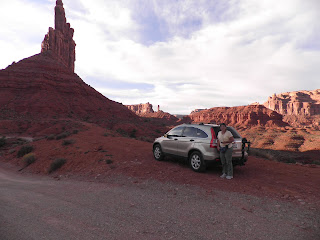
Even though the rain was headed our way, we decided to drive the 17 mile Valley of the Gods road. There were geocaches along the drive, but weather didn't permit us to stop and find them. We enjoyed seeing the sandstone buttes that have been carved over the years. This is Setting Hen Butte.
The rain continued to we set off north on US Highway 191 to Bluff, Utah. Along the way we passed Sand Island BLM area. There was a walk to some petroglyphs, by we had to pass because of the rain. We drove around the small town of Bluff, viewing the historic fort from the car and then headed back to Goosenecks.
When we arrived, the weather had cleared and we had a restful afternoon on the mesa. There were no clouds in the sky, so no sunset.
The next day we drive south again through Mexican Hat and on to Monument Valley. Our first stop was Gouldings which has been there since 1928. It was made famous by John Ford who filmed the first western at Monument Valley--Stagecoach--in 1939.
From Gouldings we drove into Monument Valley Navajo Indian Park. After looking around the museum and gift shop we set out to drive through the monuments. The road was terrible, but we made it through the drive. The road through the monuments was crowded with guided tours and tourists.
We saw the famous 'monuments' and headed back to Goosenecks. It was our last night and we were hoping for a fantastic sunset.
The afternoon was still young, the weather was great, so we went back to Valley of the Gods to see if we could find those elusive geocaches. This time we drove from east to west.
Our first stop was Seven Sailors. We hiked .3 mile to the base of the sailors and found the cache!
We continued on and found a cache named "The Gods Are Watching."
It was our last night at Goosenecks and we had a fantastic sunset!
The next day it was a short drive to Blanding, Utah, Base Camp to Adventure!


No comments:
Post a Comment