Monday, April 27, 2015

The Silos Recreation Area, MT

Like I mentioned before, we only went about 7 miles to our next campground, The Silos. We drove through the campground the day before and found it almost empty! The spot we wanted next to the water was still available.
 Canyon Ferry Reservoir is nestled between the Big Belt Mountain Range to the east and....
 ....the Elkhorn Range to the west.  Yes, that is snow on the mountain tops to the east and bad weather coming from the west!
 Since the weather was once again not cooperating with our outdoor plans, we headed in to Helena to do some shopping. It rained on us there and back.

The next day dawned bright and sunny, but once again, it was cooler due to the rain that moved through the day before. This day we would explore the Canyon Ferry Wildlife Management Area and grab a few geocaches. The area was located at the southern end of the reservoir. There were man-made islands for nesting migratory birds. We were told to watch for moose as they come down from the mountains in the winter and my still be in the area. Well, we didn't see any moose, but we did see evidence that they had been in the area--moose poop of course.  We couldn't find the first cache we searched for, but then neither had any of the cachers before us. So we took off through the cotton grass area to find the next cache.
 The next cache, of course, was located near this road---we found the cache after we approached the area from an animal path, not the road!
Since we were having trouble with the weather and yes, more rainy weather was forecast, it was time to move again after 2 nights. When we started this trip our plan was to stay 5-7 days in each area, but weather has definitely put a halt to that plan. We would have stayed and visited museums and such, but they didn't open until mid-May! When we left The Silos, we drove through Helena on US 12 and headed back to the interstate to get closer to the Montana/Idaho border. Our plan was to stop at Quartz Flat, a National Forest campground located just off a rest area on I-90. As we pulled in to the rest area to get to the campground entrance, we saw 'closed' on the campground sign! The campground was supposed to be open year round. We got out of the RV to check on the status and found the gate locked, but the campground looked inviting. Oh, well, it seems our plans are definitely made in jello this trip. Back into the RV we went and got out our camping materials to find a new stop. The next campground was a place we stopped in 2008 near the Montana/Idaho border: 50,000 Silver $ Casino. They offer free camping with water and electric hook-ups! One night was all we stayed and then it was on to Spokane, Washington, to Fairchild AFB--another stop from our 2008 trip. Weather, good or bad, we think we will find enough to keep us busy for at least a week.

Thursday, April 23, 2015

A Little Further Down the Road!

Bob and I were tired of traveling on the interstate. We had been on it since leaving Gillette, WY. The ladies at the welcome center/museum in Hardin, MT, told us about a great place to stop and eat--Wheat Montana in Three Forks.  That helped us in our decision as to where to exit the interstate. The mill/bakery/restaurant was located at the exit. We got our lunch to go as the place was busy. The food lived up to expectations--Bob and I each got a sandwich on their fresh bread, I had a reuben on rye and Bob had the Farm Hand (roast beef). We also got one of their cinnamon buns because it looked delicious. We figured it would be enough to serve us both---twice!
 After eating lunch we continued to Townsend, MT. We wanted to get off the interstate to see more of Montana, but what we got was ROAD CONSTRUCTION!!! Boy, were we glad to get to Toston where the construction ended. The entire road was gravel/dirt and traffic was one lane for quite a while. Once past Toston, we stopped in Townsend at Indian Road Campground. The sites were all on eyebrows so we found one we would fit and be able to out put the slide. This campground was provided by Bureau of Reclamation. There were 11 free sites on the Missouri River. 
On the way into Townsend we spotted a Ranger Station so we backtracked after setting up camp. We wanted information on hikes in the area. Our campground was at the south end of Canyon Ferry Reservoir where the Missouri flows south towards its headwaters. The valley is surrounded by mountains. Well, as with other places in Montana, the National Forest hiking areas don't open until mid-May.

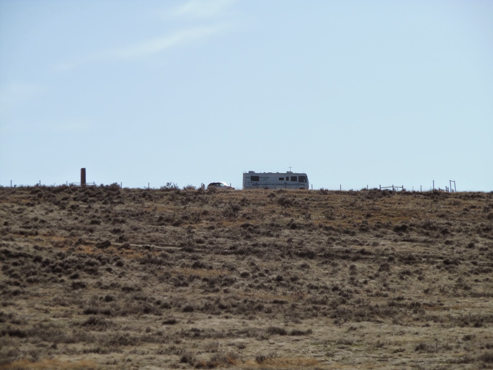
 We returned to the RV and looked over our maps--we found a ghost town--Diamond City-- along forest roads in the Big Knee Mountain Range west of our campground. Off we went!  Well, the road was okay, a few areas had some pretty good ruts to avoid, but it was a picturesque drive. It was also a long drive.
 We never did find what was supposed to be the ghost town. We did see a few deer along the way.
This abandoned building was farther down the road than where the ghost town was supposed to be.
 There weren't a lot of options for turning around, so we continued on over the mountains and out of the forest.
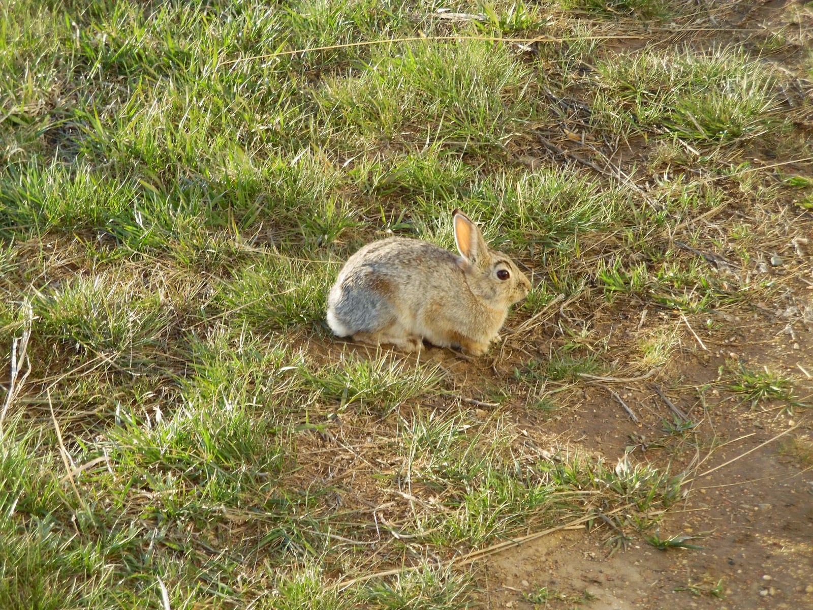
Near a ranch just beyond the end of the national forest we spotted several of these marmots. This one stopped to eye us as we passed.
 We also saw several herds of deer. These were taking turns jumping the fence into the nearby ranch. (the blob in the lower right corner is a bug smooshed on our windshield)
 Finally, we came to a paved road and found Fort Logan which was used from 1869-1879. It was moved to this spot in 1924.
It was just a small block house and didn't look much like forts I am used to seeing.

 The door was unlatched and we were able to look inside.
 From Ft. Logan, it was on to White Sulphur Springs and then our campground, 42 miles around the mountains!

The next morning we drove south on River Road to follow Lewis and Clark's explorations of this section of the Missouri River. We stopped at a turnoff where we could hike to the Crimson Bluffs.
 Clark mentioned the crimson bluffs in his journal. Just down river are York Islands, named after Clark's slave.
 Most of the land around the river is private, including York Islands.

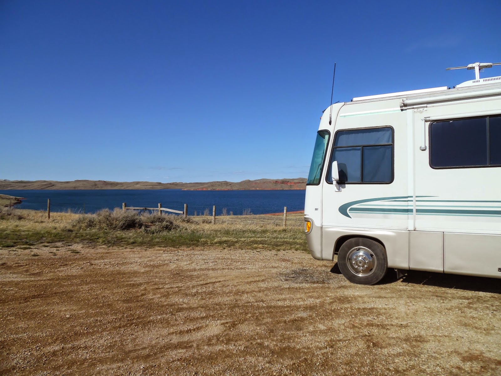
After seeing what we could, we went back to the RV and packed up to move a whopping 7 miles north--Silos Recreation Area. I wanted a waterfront site!

Our Last Day in Columbus, MT

Monday we decided geocache near Laurel, MT. We also hoped to find a good place to hike. Most of the geocaches we found were in the rolling grasslands north  and east of Laurel.
We finally found a few on the a road heading toward Billings. Just northwest of Billings we found Phipps Park. It starts at the bottom of the bluff and has several trails winding their way to the top. Well, the trails turned out to be paths for people playing disk golf! We took one of these paths to find a geocache. Unfortunately, it was guarded by the largest one of these critters we have seen on this trip. This makes number four of the slithering critters---UGH!
 We waited until he moved away from the area and then Bob used his walking stick to check and make sure he didn't have any more friends guarding the cache. He retrieved the container as I made sure the critter stayed away! We worked hard for this cache!

Then it was back to hiking and caching. There were many caches to find, but the area was larger than we expected so we didn't find them all. Some of them were down along the rocks just below the ridge, but they were easy to reach. I guess other cachers didn't think they would be easy to get to because some of the logs hadn't been signed since 2013!
 This is a view from the top of the ridge. We had a great time hiking Phipps Park and wished we had found it sooner.
 The disk golf course looked extremely challenging! If you click on this picture, there is a golf hole near the rocks with holes in them. The holes start at the base of the ridge and climb almost to the top.

Columbus, MT, was a great place to use as a base while exploring the area. But, we do have to keep moving. We are meeting friends in northwest Washington in early May. From there we will cross into Canada on our Alaskan Adventure! I sure hope the weather warms up a bit before that time. It has been in the mid to lower 30s just about every night for the last month!

Monday, April 20, 2015

Itch-Kep-Pe Park, Columbus, Montana

Like I said, we didn't travel far from Billings. Bob found a city park in Columbus, Montana where you can park for up to 10 days. That was our next destination. The park was not crowded and we found a good spot to call home for the next few days.
That afternoon we drove north of town to a small village named Rapelje. It was a long drive through rolling grasslands. When we got to the town, it looked deserted. Not much going on, so we drove back to the RV and walked the campground loops. The campground has 40+ sites and only about 1/4 of them were filled.

Sunday morning we decided to drive to Red Lodge and visit the ski area as well as the town. From Columbus we took Montana 78 south to Red Lodge. It was a winding road with excellent views of the mountains. Of course, we found a few geocaches along the way.
 Once we arrived in Red Lodge it was up the mountain to visit the ski area. This is a view back down the mountain from about 1/3 of the way up.
 The road went from being paved, to dirt, to mud, to snow! We were almost to the top....
 The ski area was closed, but there was still enough snow for some people to ski. We watched as several people prepared their skis for cross-country/downhill skiing. Bob and I stopped for a photo op overlooking a small, frozen stream.
 Just behind us was a drop of about 20 feet with the frozen stream below.
 Here I am in the parking lot of the ski area. It was a beautiful day, but a little chilly.
 On the way down the mountain, we decided to stop for lunch in Red Lodge. After walking the main street and reading menus, we picked Bogart's. It was an interesting restaurant with a photos and movie memorabilia relating to Humphrey Bogart.
To get back to Columbus, we took US212 which was a more direct route to the Montana 431 cutoff to Columbus. We found a few caches along the way and enjoyed our outing. Once back to the campground, we took a  walk around the loops and found that most people had left. I guess they had to go to work on Monday. Ahhh, it is nice to be retired and not have to hurry home to get back to work.

Billings, Montana and a Great Surprise!

Billings, Montana has a Cabela's which offers free overnight camping with a dump station and water. From Hardin we decided that would be a good place to spend the night. Once we arrived, we found out it was right next to Sam's. We also found out that Sam's offers free wi-fi to its customers. We were able to connect to Sam's wi-fi from our spot at Cabela's!

The next morning we knew we needed to walk. Our fitbit steps have greatly diminished due to the weather! Bob found a park nearby and we headed out to get some geocaches along with our steps.
 Dutcher Trail turned out to be a good place for us to get some steps before heading back to the RV and preparing to move further west. The trail wound around a lake and at one point there was a small bridge to get from one side to the other. We enjoyed this view of the lake.
 When we returned to Cabela's, it was time to visit Sisters on the Fly! Cabela's was having Ladies Day and had invited the 'Sisters' to display their trailers. I had seen Sisters on the Fly on television and was excited to see their trailers! The trailers are vintage. Some were redone like original and others were gutted and redone with modern fixtures.
 Bob and I enjoyed talking with several of the 'Sisters' and found out that one lived in Alaska for many years.
 The trailers may be small, but they  are made to be homey and comfortable for a good fly fishing trip.
After viewing the trailers, we moved about 40 miles west to Columbus, Montana. It would be our stopping place for 2 or 3 nights. Now was the time to stay in one place long enough to put the slide out and do some exploring. That's right, we hadn't put the slide out since Wilson, Kansas, due to cold and wind.  The RV was causing me to get a little claustrophobic without the extra space.

The Little Big Horn and More!

As we drove into Montana--after a stop at the Sheridan, Wyoming, Wally World for milk and other necessities--we decided to stop at Little Big Horn National Battlefield to visit Custer's Last Stand. Yes, Jennifer, I wanted to play 'Please, Mr. Custer' as we drove into the park.

 This is the monument erected in remembrance of the American soldiers that gave their all at The Battle of Little Big Horn. It is said that General Custer lost his life within 6 feet from the center of this monument.
 Each marker on the battlefield represents where a soldier fell in battle.
  This monument was at the far end of the battlefield where the survivors of the battle fought the Lakotas.
 The tour of the battlefield was thought provoking and made for a solemn morning.

After lunch in the RV, we set off for Hardin, Montana and the first Montana information center.

After looking at many brochures and listening to the locals giving information, we moved west to Billings, Montana. Cabela's would be our stop for the night.

Sunday, April 19, 2015

Douglas,Wyoming---an Unscheduled Stop

Like I said, Mother Nature has played a big part in our travel plans. First, we changed plans in Kansas due to severe weather heading that way. Now, we are changing plans again due to weather. From Ft. Laramie we went to Douglas, Wyoming. We hadn't planned to stop, but it started snowing! Not just a light snow, a heavy, wet snow. This was my view of the interstate out the front of the RV.
 
  I quickly found a park that would let us overnight in Douglas. We pulled in and hunkered down for a cold afternoon. It seems Canada Geese don't mind the snow.
 The next day we made a quick stop at the visitor center to get travel information for Wyoming. It seems our chosen route was going to receive about 10 inches of snow. Time to make a new plan! Before we left the visitor center, Bob did get my picture by one of Jennifer's favorite animals---the jackelope!
Once back at the RV, we pulled it over to the dump station, once again we both forgot to take a picture of the site, but imagine us parked on the other side of the area with the end of the RV even with where the front is now. Yes, most of the snow in Douglas had melted, but more was expected that afternoon.
While Bob emptied our tanks, I got a picture of the park entrance. It was a nice place to spend a night or two.
Then it was time to get on the road again. We found out from the visitor center and weather reports that it would be warmer north of Douglas! Our new plan was to drive north on WY59 to Gillette and then on into Montana where the temperatures were in the upper 60s! The drive was not bad and the scenery was beautiful--at least the snow was in the distance!

That night we stopped at a Wyoming Historical Site near Buffalo, Wyoming. There was room for one RV to park at the monument and overnight parking was allowed.
 Our spot overlooked DeSmet Lake. Down the hill was a fishing area, but no camping was allowed there.
 We did walk down to the lake to check things out. This was our view of the RV from the lake shore.
 The next morning, we found this visitor at our campsite. I think he was enjoying the warm air blowing from our furnace vent.
As we drove to the highway, this pronghorn stopped to pose for a picture before running off to join his herd.
Yes, our plans changed and as we left the historic site, we had no idea where we would stop for the night.