Our last day in Flagstaff we explored Walnut Canyon National Monument. I think it gets its name from the aerial view--it looks just like a walnut with a stream running around it. Long ago, it was home to cliff dwellers in the area. To get to the cliff dwellings, you have to walk down over 200 stairs. As you walk down the stairs, you can see cliff dwellings in the sides of the cliffs all around you. Only the ones on the 'walnut' are open to visitors.
This elevation marker was near the visitor center.
Here you can see the dwellings that haven't been excavated. They are on the opposite cliff from the visitor center as you walk down the stairs.
The ceilings of the dwellings seem low to us, but the people who lived in them had an average height of 5'2. Bob was able to stand up outside this room, but inside, he had to duck.
The west side of the shell was shaded most of the day and had growth to prove it. Trees and plants were healthy and tall.
Bob and I have been having fun with his new camera. The self-timer takes three pictures whereas the old camera only took one. We try to change poses for each flash!
Once again it was amazing to see how plants and trees clung to the rocks to live. The east side of the 'walnut' was in the sun most of the day and the plants lived in a more arid zone. This Indian paintbrush found just enough soil in the rocks to survive.
On our walk back to the top, Bob took a picture of the trail as we looked down to see where we had been.
Once we regained our collective breaths from the climb, we walked the rim trail. Bob and I both thought the rock across from us had petroglyphs on it, but it was hard to tell. It may have just been black marks where the water drains from the rocks.
We enjoyed our trip to Walnut Canyon, but it was time to head back to Sol to plan our next stop. When we got back to Sol, the camp host invited us to happy hour. Another couple, who live 6 months in Germany and 6 months in the states had arrived. Once again we found out how small a world this is. The gentleman who lives in Germany asked where we were from and we found out his parents had lived in Deland for many years! Then we told them about Bobby--the lady has a cousin who lives in the same village! We enjoyed our visit and will return to Pine View RV Park the next time we are in the area.
Thursday, May 11, 2017
Sunday, May 7, 2017
Our Next Stop----Flagstaff, Arizona
It was a grueling day of travel from Williams to Flagstaff---HA! We only went 25 miles! Bob and I stopped just west of Flagstaff at Camp Navajo, a National Guard camp with a beautiful campground. Fortunately for us, it opened for the season the day we arrived. Unfortunately, the gate guard thought it was closed, but he didn't want to send us away without checking so he drove to the campground and yes, it was open! Bob and I had our pick of sites and we chose the best one in the campground--it was long and our door would open toward the creek running behind the site!
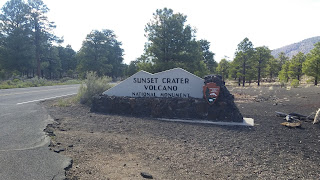
While in Williams, we found out that Flagstaff has not one, not two, but three national monuments. We planned to visit all three. Since we arrived early in the day, after lunch we headed for Sunset Crater Volcano National Monument which is north of Flagstaff. Another reason for our drive was to check the national forest campground at the entrance to Sunset Crater. Unfortunately, it wouldn't open until 4 days later.
After looking through the visitor center, Bob and I headed out to drive the forest service road that links Sunset Crater with Wupatki National Monument. We stopped at the a'a nature trail to walk through the volcanic rock. The path was paved with volcanic cinders and ash.
Along the route we had fantastic vistas of the desert beyond the volcanic craters. The painted desert and the beginning of the Grand Canyon are in the distance here.
The forest service road is about 34 miles long. We arrived at Wupatki National Monument where several pueblos have been partially restored.
Bob and I toured Wupatki. It is a large pueblo that was the cultural center for the area. It is not known exactly how many lived in this 100 room pueblo during the years it was active (about 150), but archaeologists know it was inhabited in the 1100s.
Behind me is an example of living quarters for a family--that was it, just one room for the family. Most activities were done outdoors--cooking, weaving, tool making, etc.
From Wupatki we backtracked to Wukoki to see another pueblo that was about the same age, but much smaller.
By the time we finished touring the area, it was time to head back to Sol and enjoy an evening by the stream.
The following morning, we headed back to Sunset Crater Volcano. Bob and I were ready to do some hiking. Since we planned to be out most of the day, we started by geocaching the area around old Route 66 which was near our campground.
Then it was time to head for the trails! We hiked Lava Flow Trail which is a little over 1 mile in length. The first part is accessible for all, but the rest is over a lava rock trail.
As you can see, the area is covered with black cinder rocks from the eruption of Sunset Crater Volcano about 900 years ago. It is amazing to see plants and trees growing in this dry rocky area.
From Lava Flow Trail we made our way to Lenox Crater Trail (the trailhead is in the same parking lot). This trail takes you around the cinder cone to the rim of the crater left by Lenox Volcano. As you make your way around the cinder cone trail, you get a good view of the San Francisco Peaks, the tallest in Arizona. Yes, they still have snow!
In one area, we spotted two stellar jays. The male stood on the stump and modeled for us while the female tried to sneak around the back of the fallen tree.
This is the view from the top of Lenox Crater. The trees down below are growing in what was once the inside of the volcano.
After the 2 mile Lenox Crater Trail, we walked to the Bonito Vista Trail. There was lava as far as you could see.
This plant, nestled in the lava rock, was thriving.
We saw quite a few desert lizards along all the trails. This one posed for me.
Bonito Vista Trail was the last trail for us at Sunset Crater. Time to move to a trail closer to Flagstaff.
Next stop, Elden Pueblo in the Coconino National Forest.This pueblo is still being excavated.
While we were walking the grounds, there was an elementary school group learning how to work an archaeological dig.
From Elden Pueblo we made a stop at Coconino National Forest Ranger Station to find other possible hikes in the area. The ranger gave us so much information that we decided we needed to put Flagstaff on our 'return to' list! We still had one more national monument to visit and that would be the following day. Time to return to Sol and relax by the stream! (Do you see a pattern here?)
While in Williams, we found out that Flagstaff has not one, not two, but three national monuments. We planned to visit all three. Since we arrived early in the day, after lunch we headed for Sunset Crater Volcano National Monument which is north of Flagstaff. Another reason for our drive was to check the national forest campground at the entrance to Sunset Crater. Unfortunately, it wouldn't open until 4 days later.

Along the route we had fantastic vistas of the desert beyond the volcanic craters. The painted desert and the beginning of the Grand Canyon are in the distance here.
The forest service road is about 34 miles long. We arrived at Wupatki National Monument where several pueblos have been partially restored.
Bob and I toured Wupatki. It is a large pueblo that was the cultural center for the area. It is not known exactly how many lived in this 100 room pueblo during the years it was active (about 150), but archaeologists know it was inhabited in the 1100s.
Behind me is an example of living quarters for a family--that was it, just one room for the family. Most activities were done outdoors--cooking, weaving, tool making, etc.
From Wupatki we backtracked to Wukoki to see another pueblo that was about the same age, but much smaller.
By the time we finished touring the area, it was time to head back to Sol and enjoy an evening by the stream.
The following morning, we headed back to Sunset Crater Volcano. Bob and I were ready to do some hiking. Since we planned to be out most of the day, we started by geocaching the area around old Route 66 which was near our campground.
Then it was time to head for the trails! We hiked Lava Flow Trail which is a little over 1 mile in length. The first part is accessible for all, but the rest is over a lava rock trail.
As you can see, the area is covered with black cinder rocks from the eruption of Sunset Crater Volcano about 900 years ago. It is amazing to see plants and trees growing in this dry rocky area.
From Lava Flow Trail we made our way to Lenox Crater Trail (the trailhead is in the same parking lot). This trail takes you around the cinder cone to the rim of the crater left by Lenox Volcano. As you make your way around the cinder cone trail, you get a good view of the San Francisco Peaks, the tallest in Arizona. Yes, they still have snow!
In one area, we spotted two stellar jays. The male stood on the stump and modeled for us while the female tried to sneak around the back of the fallen tree.
This is the view from the top of Lenox Crater. The trees down below are growing in what was once the inside of the volcano.
After the 2 mile Lenox Crater Trail, we walked to the Bonito Vista Trail. There was lava as far as you could see.
This plant, nestled in the lava rock, was thriving.
We saw quite a few desert lizards along all the trails. This one posed for me.
Bonito Vista Trail was the last trail for us at Sunset Crater. Time to move to a trail closer to Flagstaff.
Next stop, Elden Pueblo in the Coconino National Forest.This pueblo is still being excavated.
While we were walking the grounds, there was an elementary school group learning how to work an archaeological dig.
From Elden Pueblo we made a stop at Coconino National Forest Ranger Station to find other possible hikes in the area. The ranger gave us so much information that we decided we needed to put Flagstaff on our 'return to' list! We still had one more national monument to visit and that would be the following day. Time to return to Sol and relax by the stream! (Do you see a pattern here?)
Friday, May 5, 2017
Lake Havasu City, Arizona and on to the Grand Canyon
It was quite a drive from Ridgecrest, California to Lake Havasu City, Arizona---there were a lot of changes in elevation along the way. We finally made it to Havasu and found 3T's RV Products and Parts. We had an appointment for Sol. When we arrived, we weren't sure how long we would be in the area--the technician needed to evaluate the bedroom slide mechanism to know what repairs were needed. The following morning, Sol was pulled into a bay and evaluated. Yes, the mounts were allowing the motors to turn and causing the slide to jump. Not only that, but a screw at the top of the rear slide had been digging into the side and scraped the paint! Thankfully, 3T's had new and improved mounts to install in the slide. The installation would take about 4-5 hours and then Sol would be ours again. Bob and I decided to take care of some maintenance on the car---oil change--and just look around town. We ate lunch at Hangar 24 Brewery. If you are ever in the area, it is a good place for lunch and is located at the airport, across the road from The Shops of Havasu.
Of course in our time looking around town, I forgot to take the gratuitous picture of the main tourist attraction in Lake Havasu City--London Bridge. When we got Sol back, we needed to stay at 3T's for one more night so the silicone could set. As we spent the night in Havasu, we plotted the next few days of our adventure.
Bob likes to drive Historic Route US 66 whenever it is available. This trip we drove north of Lake Havasu City to Kingman where we caught Route 66 and headed east toward Seligman. We stopped at Grand Canyon Caverns to look around.
The back room in the small store had lots of memorabilia from the 50's and 60's. We enjoyed looking around inside, but there was a definite chill in the air outside! When we left Havasu, the temp was HOT! Since we traveled north and gained altitude, the temp was much cooler.
After eating lunch in Sol, it was time to move on down the road to Williams, Arizona---Gateway to the Grand Canyon.
We had not planned a place to stay so we took the first available which turned out to be a Passport America Park--Grand Canyon Railway RV Park.
After little or no thought we decided to take the train to Grand Canyon the following day. Before boarding the train, there was a shootout at the corral near the tracks. As with most shows of this type, it was pretty corny.
The Grand Canyon was breathtaking as always! The changing light from the clouds and the sun changed the view each time you looked.
Bob and I walked the rim trail for most of our time. We came across Big Red, the Arizona Cardinals mascot, near Hopi House. He was waiting for the NFL to record the Cardinals draft choice.
After the photo op, Bob and I continued along the trail. We had 3 1/2 hours to explore before boarding the train for our return trip to Williams.
From Kolb House, we got a good picture of El Tovar, the original lodge. We ate our lunch in the lounge of El Tovar.
We enjoyed our trip to Grand Canyon, but were glad to board the train for our return trip.
The next day Bob and I walked around the town of Williams which was once bustling on Route 66--that is until I-40 bypassed the town. Now the town has been revived with all the nostalgia that accompanies Route 66.
Many of the buildings are original.
There were quite a few old vehicles around town. My brother would have enjoyed looking at this old bronco.
Everywhere you looked there was something recalling Route 66's glory days.
This sign was in front of the Route 66 Cafe.
Williams even has a gas station museum.
Our stay in Williams was enjoyable, but it was time to head east...not much farther, as our next stop was ........
......to be continued!
Of course in our time looking around town, I forgot to take the gratuitous picture of the main tourist attraction in Lake Havasu City--London Bridge. When we got Sol back, we needed to stay at 3T's for one more night so the silicone could set. As we spent the night in Havasu, we plotted the next few days of our adventure.
Bob likes to drive Historic Route US 66 whenever it is available. This trip we drove north of Lake Havasu City to Kingman where we caught Route 66 and headed east toward Seligman. We stopped at Grand Canyon Caverns to look around.
The back room in the small store had lots of memorabilia from the 50's and 60's. We enjoyed looking around inside, but there was a definite chill in the air outside! When we left Havasu, the temp was HOT! Since we traveled north and gained altitude, the temp was much cooler.
After eating lunch in Sol, it was time to move on down the road to Williams, Arizona---Gateway to the Grand Canyon.
We had not planned a place to stay so we took the first available which turned out to be a Passport America Park--Grand Canyon Railway RV Park.
After little or no thought we decided to take the train to Grand Canyon the following day. Before boarding the train, there was a shootout at the corral near the tracks. As with most shows of this type, it was pretty corny.
The Grand Canyon was breathtaking as always! The changing light from the clouds and the sun changed the view each time you looked.
Bob and I walked the rim trail for most of our time. We came across Big Red, the Arizona Cardinals mascot, near Hopi House. He was waiting for the NFL to record the Cardinals draft choice.
After the photo op, Bob and I continued along the trail. We had 3 1/2 hours to explore before boarding the train for our return trip to Williams.
From Kolb House, we got a good picture of El Tovar, the original lodge. We ate our lunch in the lounge of El Tovar.
We enjoyed our trip to Grand Canyon, but were glad to board the train for our return trip.
The next day Bob and I walked around the town of Williams which was once bustling on Route 66--that is until I-40 bypassed the town. Now the town has been revived with all the nostalgia that accompanies Route 66.
Many of the buildings are original.
There were quite a few old vehicles around town. My brother would have enjoyed looking at this old bronco.
Everywhere you looked there was something recalling Route 66's glory days.
This sign was in front of the Route 66 Cafe.
Williams even has a gas station museum.
Our stay in Williams was enjoyable, but it was time to head east...not much farther, as our next stop was ........
......to be continued!
Monday, May 1, 2017
Ridgecrest, California--Home of China Lake NAWS
Bob and I were to meet Connie and Larry one more time before saying our goodbyes. Sierra Vista RV Park at China Lake NAWS was our meeting place. Connie and Larry left us for a week to visit family in the Los Angeles area while we were in Lone Pine. Bob and I would spend a week with them at China Lake before we all went our separate ways, us to start the long trip home and them to head for their summer gig in Colorado.
If you take a look at the map, you will see we didn't have far to travel to get to Ridgecrest. We were in no hurry to get on the road, but we still managed to leave Tuttle Creek before 10 a.m. As we drove south on US395, we once again saw Owens Dry Lake--where Los Angeles bought all the land around the lake and pumped the water to L.A., leaving the lake dry. Today, work is being done to 'refresh' the lake. Some areas have water and dust mitigation is in progress. High winds frequently blow through the area causing severe dust storms. Just beyond Owens Dry Lake is Crystal Geyser bottling plant where a lot of the area's bottled water originates.
Once we arrived at Sierra Vista, we got set up with full hook-ups and were ready to spend a week with friends.
Bob and I went geocaching on a windy day while Larry and Connie did computer work. I first saw a plant like this on our way to Death Valley. It looks like somebody sprayed it with orange silly string! These were all over the area where we cached. When the orange first 'explodes' on the plant, it is moist. As it ages, it dries and becomes lighter in color as well as brittle.
We had a successful day caching, but we stopped at 52 due to the WIND! Yes, the wind was howling. When we got back to Sol, we had to bring in the kitchen slide because the wind was making the slide topper billow up like a cloud. In fact, the slide stayed in for most of the time we were at Sierra Vista.
The following day Connie and Larry took us to Trona Pinnacles. It is another area where many movies have been made. Lost in Space, Star Trek V, Battlestar Gallactica, and Planet of the Apes are a few. The tufa spires have distinct shapes that are easy to identify in movies.
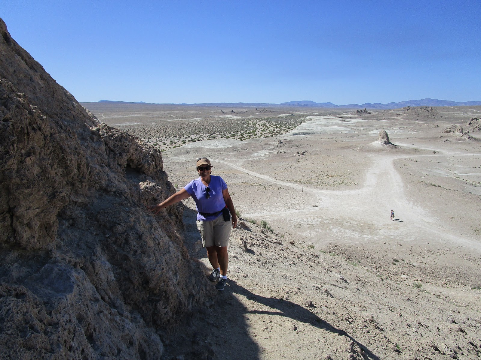
Bob and I went looking for geocaches while Larry and Connie flew his drone around the pinnacles. Here Bob and I are on the side of one of the towers while Connie and Larry watch.
Here I am getting ready to get the cache. It was quite the climb to get to this one!
Success! I found it and signed the log!
Here is a view of another section of the pinnacles. It is easy to see why this area was used for space movies.
The entire area is other-worldly. Bob and I had fun giving the formations different names depending on the way we were looking at them.
Another day we visited Randsburg, California, The best way to describe this small town: a living ghost town. Here, Larry is waiting for the rest of us to walk around town. He didn't have long to wait, it is a small town!
There were a lot of abandoned vehicles and other things on the main street.
On the way out of town, we stopped to visit the jail.
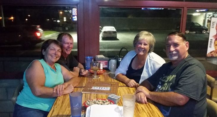
We decided to have lunch in Ridgecrest. I had seen several billboards for Schooner's so we set out to find it. It was off the main road and the sign was hard to see, but it was worth finding. The lunch specials were great and not too pricey. In fact, it was so good, we ended up eating there a total of 3 times during our stay. On our last night with Larry and Connie, we even played pegs and jokers after our meal. By the way, the girls won this trip. (The guys won the Alaska trip.)
We said goodbye to Larry and Connie as they had a meeting to attend before their work starts in Colorado. Bob and I stayed on a few more days since the wind was howling again and we didn't want to drive in heavy winds.
We took the time to do a bit more laundry, go bowling, and visit the U. S. Naval Museum of Armament and Technology. The museum was close enough for us to walk, but that wind changed our plans again. We drove the quarter mile to the museum. If you are a real techie, this is the museum for you. It was not for me---there were too many missiles with detailed information on how they were made and when they were used.
Bob and I enjoyed our time with Larry and Connie and our trip to Ridgecrest, but it was time for us to move on. Our next stop--Lake Havasu City, Arizona, to get Sol's bedroom slide checked since it was starting to jump when we pull it in.
If you take a look at the map, you will see we didn't have far to travel to get to Ridgecrest. We were in no hurry to get on the road, but we still managed to leave Tuttle Creek before 10 a.m. As we drove south on US395, we once again saw Owens Dry Lake--where Los Angeles bought all the land around the lake and pumped the water to L.A., leaving the lake dry. Today, work is being done to 'refresh' the lake. Some areas have water and dust mitigation is in progress. High winds frequently blow through the area causing severe dust storms. Just beyond Owens Dry Lake is Crystal Geyser bottling plant where a lot of the area's bottled water originates.
Once we arrived at Sierra Vista, we got set up with full hook-ups and were ready to spend a week with friends.
Bob and I went geocaching on a windy day while Larry and Connie did computer work. I first saw a plant like this on our way to Death Valley. It looks like somebody sprayed it with orange silly string! These were all over the area where we cached. When the orange first 'explodes' on the plant, it is moist. As it ages, it dries and becomes lighter in color as well as brittle.
We had a successful day caching, but we stopped at 52 due to the WIND! Yes, the wind was howling. When we got back to Sol, we had to bring in the kitchen slide because the wind was making the slide topper billow up like a cloud. In fact, the slide stayed in for most of the time we were at Sierra Vista.
The following day Connie and Larry took us to Trona Pinnacles. It is another area where many movies have been made. Lost in Space, Star Trek V, Battlestar Gallactica, and Planet of the Apes are a few. The tufa spires have distinct shapes that are easy to identify in movies.
Bob and I went looking for geocaches while Larry and Connie flew his drone around the pinnacles. Here Bob and I are on the side of one of the towers while Connie and Larry watch.
Here I am getting ready to get the cache. It was quite the climb to get to this one!
Success! I found it and signed the log!
Here is a view of another section of the pinnacles. It is easy to see why this area was used for space movies.
The entire area is other-worldly. Bob and I had fun giving the formations different names depending on the way we were looking at them.
Another day we visited Randsburg, California, The best way to describe this small town: a living ghost town. Here, Larry is waiting for the rest of us to walk around town. He didn't have long to wait, it is a small town!
There were a lot of abandoned vehicles and other things on the main street.
On the way out of town, we stopped to visit the jail.
We said goodbye to Larry and Connie as they had a meeting to attend before their work starts in Colorado. Bob and I stayed on a few more days since the wind was howling again and we didn't want to drive in heavy winds.
We took the time to do a bit more laundry, go bowling, and visit the U. S. Naval Museum of Armament and Technology. The museum was close enough for us to walk, but that wind changed our plans again. We drove the quarter mile to the museum. If you are a real techie, this is the museum for you. It was not for me---there were too many missiles with detailed information on how they were made and when they were used.
Bob and I enjoyed our time with Larry and Connie and our trip to Ridgecrest, but it was time for us to move on. Our next stop--Lake Havasu City, Arizona, to get Sol's bedroom slide checked since it was starting to jump when we pull it in.
Subscribe to:
Posts (Atom)