Wednesday, January 9
We packed the rv and left City of Rocks State Park in New Mexico to head for Tucson, Arizona. It was about 280 miles so it took about 5 hours. We went from the Chihuahuan Desert into the Sonoran Desert. As we approached Tucson saguaro cacti started dotting the landscape. At a rest area about an hour from Davis Monthan AFB, Joyce called to determine campsite availability. We were told we would go into overflow for one night and then have a full hook-up site the next day.
When we arrived in Tucson, we drove through part of the airplane boneyard on the way to the AFB.
We went into overflow and were last on the list to get a site the next day. If we had been 20 minutes later, we would have waited another day for full hook-up.
We set up in overflow and drove around base to see where everything was located. We splurged and had fast food for dinner from the PX's food court.
Thursday, January 10
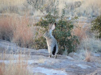
We had to be in the FamCamp office at 9 a.m. to be sure we got our site. There was someone who came in after us hoping for a no show so they could get a site. We are in site 38, one of the few back-in sites. Our site is paved and desert landscaped with rocks. There is a bunny living in the area near our site.

The temperature dips into the 30s at night, but is in the 60s during the day--very comfortable once it warms up.
After setting up camp, we went to the commissary to replenish our groceries. After putting everything away we started looking at all the material we were given when we registered. There are so many things to do and see around Tucson that we had trouble deciding what to do first. Several places are closer to Fort Huachuca so we are going to see if we can get reservations at their famcamp.
We decided to go into downtown Tucson Friday to see where it all began.
Friday, January 11
Tucson reminds us of El Paso, situated at the foot of mountains in the desert. As we drove downtown we went under the rattlesnake pedestrian overwalk that is one of the sights to see in Tucson. I don't think I want to walk through a rattlesnake (it is the official snake of Arizona)!
We found a parking spot near the visitor center where we would pick up a map of the presidio walking trail. It is a 2 1/2 mile trail through the downtown area with many historic places marked. In fact, the trail is marked by a turquoise line painted on the sidewalk.
The visitor center is number 7 on the trail so we walked the trail in reverse to get to Presidio San Agustin del Tucson is number one. The presidio was Tucson's first fort. It was established by that fine Spanish officer Colonel Hugo O'Conor in 1775. The presidio is being restored and has many artifacts found on the site. This is the gate at the entrance.
The mural depicts life in the late 1700s, early 1800s. You can see the office buildings of Tucson all around the presidio.

We found a spot in the sun for a picture. Yes, Bob was cold!
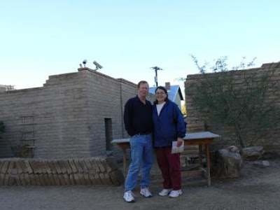
In the original fort this tower was 20 feet tall.

After leaving the presidio we walked most of the trail through Tucson. It went by the train depot where Wyatt Earp and Doc Holliday killed one of the Clanton gang. Bob posed with Wyatt and Doc.

We stopped short of walking the full trail because we were parked at a 2 hour meter. We got to the car as the meter went to zero. You are allowed 2 hours on the meters with no feeding the meter to add time! We were parked nest to St. Augustine Cathedral which was started in 1896. Renovation work is being done on part of it now. We took this picture from several blocks away as we didn't realize we were parked next to it! Our view was hampered by construction safety walls.

When we returned to Davis Monthan, we ate lunch, rested, then walked to Warrior Park at the entrance of the base.
There are planes on display with tags telling about them and their duties. Joyce is standing next to an OV10. It was used for forward air control.

The paths through the park were either concrete or gravel. Some areas would have grass in summer and spring.

Here we are next to the C130 named for Tucson.

This U2 was interesting. The landing gear fell off after take-off and the plane landed on the downturned skids at the end of each wing.

We enjoyed walking through all the planes and reading the stories.
Saturday we will venture to the area southwest of Tucson to see Tucson Studios and the Arizona-Sonora Desert Museum.
If any of you have been to Tucson and know of something we should see, please let us know!

 The stunt show took place at the old mission from the movie.
 You know Bob, he can't go anywhere without wanting a nap! He rested in the Rio Lobo jail.
 Old Reno was used in many movies and television shows--Wild, Wild West was Joyce's favorite.


 The stores on the main set were used in Little House on the Prairie.
 High Chaparral was also filmed at the studio.
 We enjoyed Miss Kitty's Can Can Show.
 The actors were muli-taskers. The bad guy in the bank shoot out was also in the stunt show. Miss Clementine (middle cancan dancer) was also the lead in the stunt show.
 Old Tucson had the prerequisite forms for us to pose as barkeeper and waitress.
 After spending most of the day at Old Tucson we drove to find the Sonora Desert Museum & Zoo. It is one of the top 10 zoos in America. We also drove a little further to find the West Saguaro National Monument. We watched the short movie, looked in the gift shop, and returned to the rv. Both places closed at 5 p.m. and it was already 3 so we will return another day to explore the Desert Museum and hike at West Saguaro National Monument.

 On our way out of the park, we found the cache at the observation area. It was 35 feet off the given coordinates.
 The building had many artifacts from the mining community.
 From Pinos Altos we drove into Silver City to visit the historic area. Silver City is a town filled with Old West and mining history.
 After lunch we visited the museum which used to be a private home.
 We were able to walk up to the cupola to see the view of Silver City. The cupola was used to cool the house on hot summer days. The four windows were opened so the rising heat could escape the house.
 The sunset was again very colorful.
  There are several windmills to pump the water at the park. This one is actually electric!
 It was a short ride from Columbus, New Mexico to City of Rocks. We arrived at 10 am. This is a view of the campground. Our rv is the second from the left.
 We like the campground with one exception, it doesn't have a dump station. We are going to be careful with water usage here as we want to stay awhile. It will be our base to visit Silver City, Gila Cliff Dwellings, Pinos Altos and other places of interest in the area.
  After camp was set and we had a bit of lunch, Bob and I set off to walk the Hydra Trail around the park. The trail began by winding through the desert area east of the campground. We rested at the bench under the only tree in the area.
  The trail wound through the desert and then back into the rock area.
 We climbed in and around the rocks. Native Americans lived here long ago.
 You can look at the rocks and find different shapes in them. Joyce thinks this one looks like the eye of a dragon.
 Some places it was too difficult for Bob to run back to be in the picture.
 Saturday evening there was a gorgeous sunset. The clouds looked like red velvet before it was finished.
 Sunday we packed a lunch and set off for the Gila Cliff Dwellings. We visited there in the late 70s when Bobby and Jennifer were very young. It was one of our favorite places to camp when Bob was stationed at Ft. Bliss.We drove on New Mexico SR 15 which part of the scenic byway through the forest. It is a very narrow road that reminded me of KY 1427, only this time we were in the CRV, not the rv!
 The weather was supposed to be bad for the day, but occasionally there were bright spots.

 The 40 mile drive takes about 2 hours because of the winding mountain road.


 The ceilings are heavily marked with soot. Some of the ceilings have fallen over the years. The black marks on these rocks are soot.

 We completed the scenic drive which took us past Santa Rita Copper Mine and this time the big trucks were running! They are huge!