Tuesday, March 6, 2018

Ocean Springs, MIssissippi

If you look on the map, it is not a great distance from Pensacola to Ocean Springs, Mississippi. We took our time and stayed on back roads until we approached Mobile, Alabama. We have found that it is better to travel through Mobile on I-10 because of the tunnels. One time when we were going through Mobile, not on the interstate, we came upon a tunnel where it was questionable whether we would clear the entrance. We made it by inches! So, after that trip, we always stay on the interstate to 'clear' Mobile. We exited the interstate just before Ocean Springs. Our next stop was Davis Bayou Campground, another part of Gulf Islands National Seashore. We would use that as our base for the next week.
 The campground was nice and it had a short nature trail that led to the visitor's center. Along the way we found some interesting trees.
 One day we drove to Pascagoula to do some geocaching. It was a cold, windy day, but we thought we might find a few caches. A few was all we found. Many were missing.
 Since the weather wasn't cooperating with our outdoor activities, we found a nice museum in Biloxi, Maritime and Seafood Industry Museum. The museum chronicled different types of boats used by the locals as well as a history of the seafood industry---especially oysters and shrimp. This is Nydia, a sloop built in 1898 and restored not too long ago. She was a frequent winner in local sailing races.
 On our other days, we spent a little time in some of the casinos. Friends from home met us in Biloxi. Bob played golf with Rich on the only good day we had. While the boys golfed, Marilyn and I played slots. We had all planned to stop at Bill and Bonnie's in Crawfordville to do an escape room. Unfortunately, Bill was under the weather and we decided to stop another time.

Since we didn't go to Crawfordville, Bob and I took I-10 all the way to Chattahoochee, Florida. We stopped at East Bank Corps of Engineer Campground. We got the last site! It had just been graveled and it was a bit muddy since it was raining. We stayed for three nights, then headed home to get ready for the next leg of our trip.

Our Next Adventure--The Florida Panhandle

Soooo, I haven't posted in quite a while. Yes, we are on the road again, but just for a short time. Short to us is 2 months. We left home and made our way to Crawfordville, Florida, to visit our friends for a night before heading to Pensacola, Florida. While we were checking in at Blue Angels' Recreation Area, the clerk told us the best and freshest seafood in the area is at Joe Patti's at the end of A Street in Pensacola. You can visit the restaurant a block away, or you can choose your seafood and have them steam it in the seafood deli. We chose the latter, and boy, was it good.

Sol was parked in site 50 of Battleship Row. It was a good site, away from most campground traffic and backing on the woods. All the sites in this loop had concrete pads and the trees were not a hazard. The other campground loop had dirt pads and the trees would have posed quite a problem for Sol if we had chosen that loop.
While at Blue Angel's Recreation Area we were able to do some hiking and exploring. Our first hike was around the many trails at the recreation area. The trails were on the outer edges of the three disc golf courses located at the rec area.


Our next hike was at Tarkiln Bayou Preserve State Park. We walked a portion of the long trail, Perdido Bay Trail. Bob had loaded our GPS with geocaches and we added a few to our total. Along the trail we found some gnarly trees.
 Perdido Bay Trail loops near Perdido Bay.
 
After we did about 3 miles on Perdido Bay Trail, we retraced our steps and walked Tarkiln Bayou trail. This trail is a boardwalk over the swamp to the bayou which empties into Tarkiln Bay. In the spring, there are unusual plants which are unique to the area. Unfortunately, it was not spring and no sign it was coming any time soon.
 Another day we went to Gulf Islands National Seashore on Perdido Key. Even though it was windy and cool, were able to walk the short boardwalk nature trail.
 As you can see from this picture, the handrails are warped even though they are the composite material used in most new decks.
 This picture shows all the handrail is warped. So far the foot boards are straight, maybe because they have more nails to hold them in place.
 From the nature trail we walked across the main road to the beach area.
From Perdido Key, we returned to the Pensacola area to visit Fort Barancas which is located on Pensacola Navy Station.
 Our next hike, we went to Big Lagoon State Park to hike.The first stop was the observation tower. Yes, the wind was blowing and it was another cool day.
 The Blue Angels treated us to a fly-by. It is hard to tell from this picture, but there are three planes flying in formation.
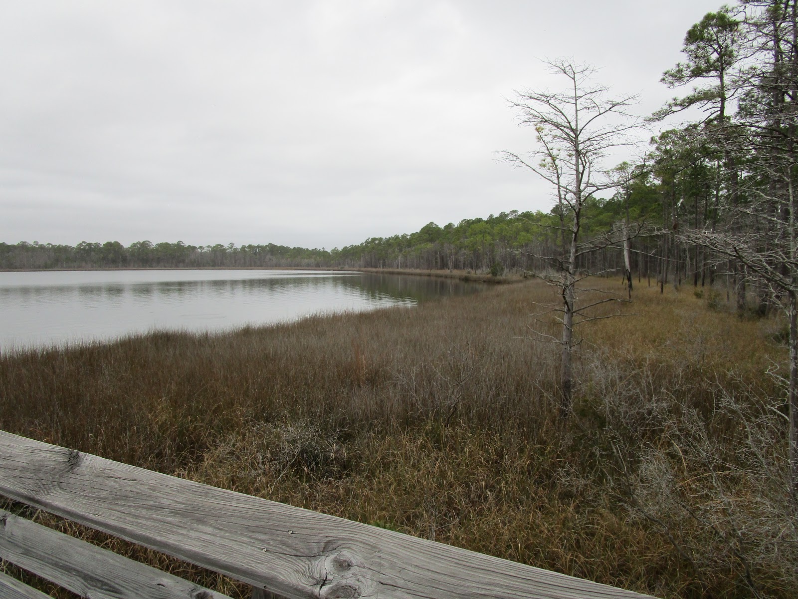
 There were several places with decks overlooking small lakes. And yes, there were geocaches located near each one.
 Other than the Blue Angels, the only other interesting sight was this armadillo.
Our days of hiking near Pensacola came to an end as the following day, our last day in the area, was predicted to be rainy and cold. That day was our day to visit the base bowling alley. Bowling is one of our favorite past times when the weather doesn't cooperate.

Next stop......Ocean Springs, Mississippi!

Saturday, September 30, 2017

Hurricane Irma and Heading Home

From Dillon, South Carolina, we made it to Petersburg Corps of Engineer Park near Appling, Georgia. We were definitely keeping an eye on Hurricane Irma. As with most hurricanes, her path was unpredictable. It looked like she would head east of Augusta, Georgia, but then she changed directions again! As you can see, our campsite was heavily wooded. Strong winds could be a disaster in this area.


Bob and I were able to get some hiking in while on hurricane watch at Petersburg. One trailhead for Bartram Trail is located near the entrance to the campground. The trail follows the shoreline of Strom Thurmond Reservoir. One day we hiked it to the east, the next, we hiked to the west. The trail is multi-use and is good for mountain bikes, also.
Still keeping a watch on Irma, we decided we should do laundry just in case power is out when we return home.  Irma hit home on Sunday, and made her way to the Augusta area on Monday. Since we were in such a wooded area, we made the decision to move Sol to an area without trees. Bartram Trailhead was the area of choice. We had about 2 side by side football fields of open area where we parked Sol--slides in, of course. The winds picked up Monday afternoon and we watched several trees fall at the perimeter of our open space. One tree fell on the power lines across the campground road. We were glad we were out of the trees! Other campers were not so lucky. When we were checking out on Tuesday morning, we found out that our camping loop lost about 200 trees and there were about 8 campers still in the loop! We couldn't get near to see the destruction.

Due to hurricane assistance trucks heading south, we drove US221 and US301 south. There was very little traffic and we were able to top off Sol's tanks in Baxley, Georgia. Since there were so many trees down, we decided to drive all the way home. The only things not bothered by Irma were the love bugs!
 When we arrived in our neighborhood, the streets were already lined with hurricane debris.
After cleaning Sol, we parked in our driveway where we could safely run our generator. Our street was without power and we were told it would be Sunday before power was restored. 

Since arriving home, we have cleaned our yard and are starting to make plans for our next adventure! Your guess is as good as mine as to where we will go next!

Thursday, September 7, 2017

Exploring More of the North Carolina Coast

After another short drive we arrived at Cherry Point MCAS in Havelock, North Carolina. It would be our base to explore Lower Outer Banks. After getting set up, we went to the commissary and exchange to pick up a few things.
Sunday we drove to Beaufort. It is a nice small town on Lower Outer Banks.
We wanted to visit the Maritime Museum, but it didn't open until the afternoon. We did find a painted rock outside the museum.
We stopped in Cape Lookout National Seashore's visitor center. The visitor center is located in what was once Beaufort's main post office. Our next trip we plan to take the ferry to the seashore to tour the lighthouse and to see the wild horses.
After our trip to Beaufort we headed down the coast to Fort Macon. It is built in a style similar to other forts of the time. It is also the first state park in the North Carolina State Park system circa 1936. It was used in the Civil War  through World War II. In WWII, the interior of the fort wasn't used, but temporary buildings were constructed outside the fort to house the military. As soon as the war was over, the temporary buildings were taken down and the fort returned to park status.
Monday we returned to the coastal islands to visit one of four state aquariums in North Carolina.
Behind the aquarium is a trail through the marshland. This bridge was tricky--just when you thought you had your balance, the slats sunk toward the water. It was the strangest bridge we have encountered while hiking. Bob told me not to worry....he had me.....on camera, that is.
We enjoyed our trip to the aquarium. There were many families enjoying the fish and reptiles on the day before school started. This sculpture is near the entrance.
Tuesday we decided we needed some steps so off we went to Croatan National Forest. We chose Beede Trail at Flanners Beach Recreation Area. This bridge was pretty straight forward--no sudden dips or dives as we crossed it!
As with most people in the south, we are watching Hurricane Irma. Our original plans have changed, we are not going to continue down the coast, instead, we are heading south toward the GA/SC border.
We will continue to watch Irma and hope she turns east!

After driving in the rain for most of the day, we stopped at South of the Border to regroup and find a place to spend the night. Passport America comes through with a park six miles away! Bass Lake Campground, here we come!

Sunday, September 3, 2017

Elizabeth City, North Carolina--Our First Coast Guard Campground

Bob and I are back to short travel days! From Williamsburg to Elizabeth City was only 92 miles! Most of our route was on I-64 until we crossed into North Carolina, then we traveled US 17. I have to say we were pleasantly surprised by US 17. It was a nice, smooth road compared to I-64 and it even had rest areas!

We stopped for lunch at The Great Dismal Swamp State Park which happened to be located at a rest area! We were able to go in the rest area's visitor center and gather information on things to see and do in the Elizabeth City area. After lunch, we walked to the state park and learned a bit about the swamp. Behind the park visitor center we walked the 1/2 mile boardwalk through the swamp. The Great Dismal Swamp Canal was built in the 1800s to help move goods along the waterways to North Carolina ports. Today, there is a bike trail along the side of the canal and you can kayak or canoe on the canal.

After our stop, it was on to Elizabeth City Coast Guard Station where we would spend five days. We had a great site with a view of the Pasquotank River.
 Our cell phone, Internet and television all received great signals at our site. Unfortunately, there was a tropical depression approaching the area. We had two days of rain before we were able to get out and explore. Our first foray in to Elizabeth town took us to the waterfront. For those with boats, the city offers free berths for tie-up while you are in town. We also visited Albemarle Museum which offers history of the area.
 From Elizabeth City we drove to the Outer Banks. Our lunch stop was Weeping Radish Brewery. Guy Fieri of Food ChannelTripleD fame reviewed it several years ago. Most things on the menu were grown on their farm and made in their kitchen. Bob and I shared the reuben sandwich--they made the pastrami, grew and fermented the sauerkraut, and made the marbled rye bread. It was DELICIOUS!
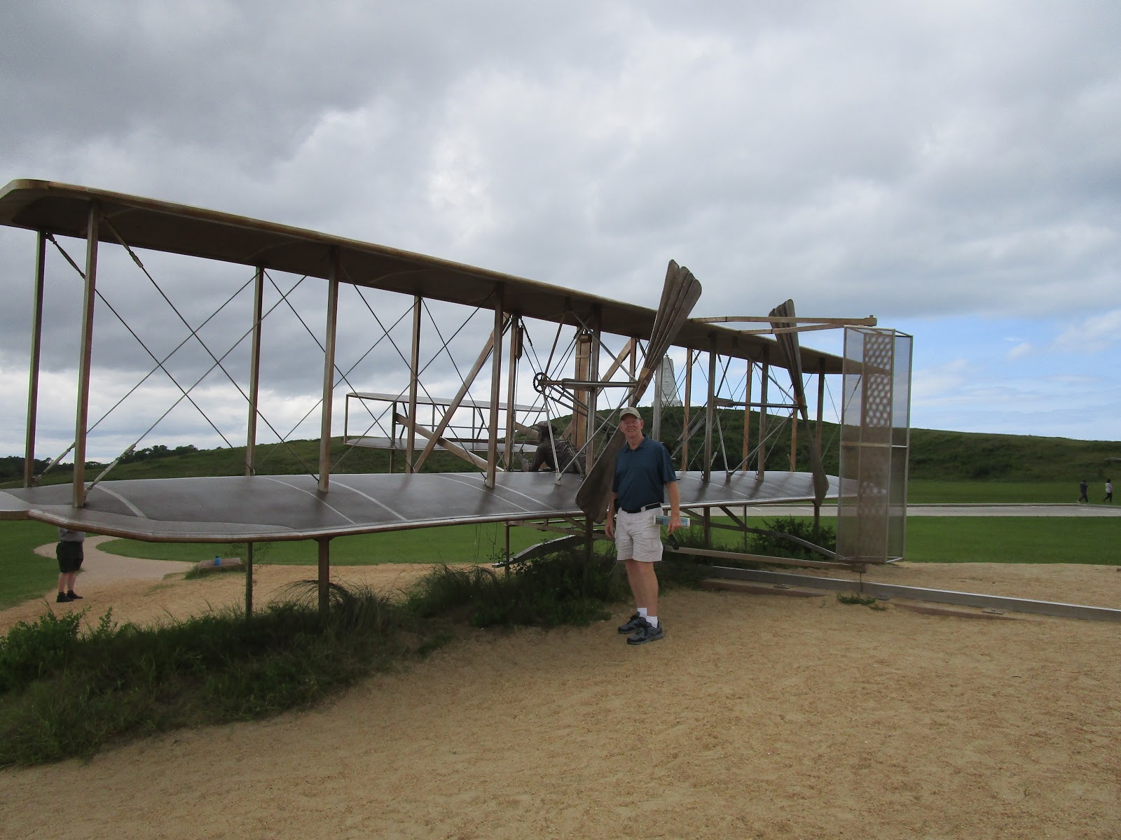
 After lunch, we headed to Kill Devil Hills to visit the Wright Brothers Monument. When it first opened in 1932, this monument housed the visitor center. Now, the bottom of the monument is closed and the visitor center built in the 1950s is being refurbished.
 The original flyer is in the Smithsonian and the 1905 version is at Wright Patterson Air Museum in Dayton, Ohio. I always thought this plane looked like it flew backwards!
 We walked along the path where the first flight occurred. This stone marks the lift-off point....
 ...and markers like this mark the length and time of each of the four flights.
 From the Wright Brothers Monument, we drove to Fort Raleigh,  site of the lost colony of Roanoke Island. It was an interesting place that made you go, ' hmmm, what really happened to the original settlers?' After a long day on the road sightseeing, it was time to head back to Sol to make our plans for the next day.

We planned to head north to Merchants Mill Pond State Park to do some hiking. With all the rain we knew it may be wet, but that didn't stop us!
 True to the entrance sign, it was another swamp, in fact, Great Dismal Swamp was not too far from this state park. The early settlers made canals along many of the swamps to make trading by boat easier.

After a look through their visitor center, Bob and I headed for Lassiter Trail, a five mile loop located a little over 1/2 mile from the visitor center. We enjoyed our hike through the swamp....there were only a few places where we had to avoid standing water from the rain. We saw one gopher tortoise and deer tracks, but no other animals.

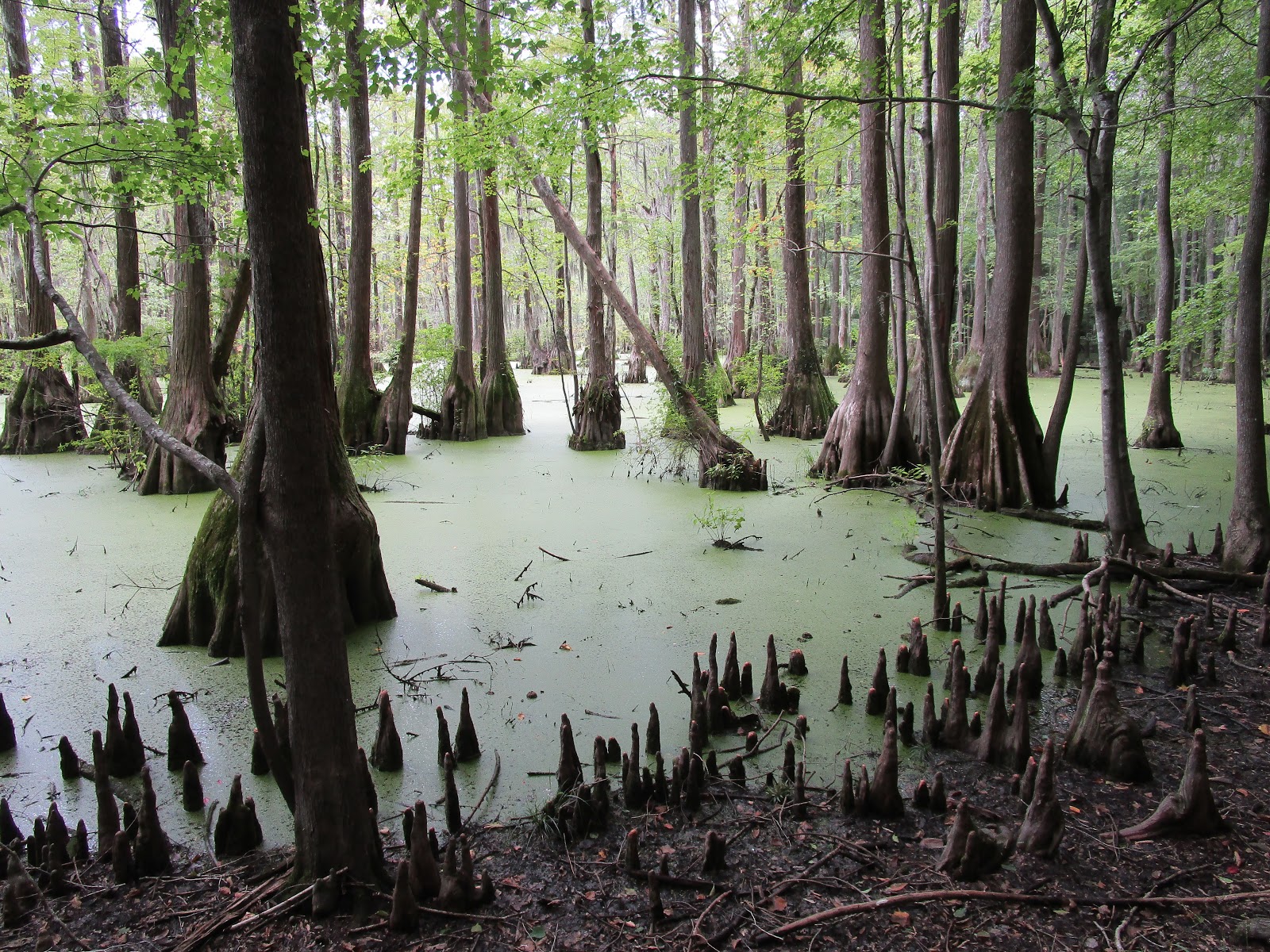
Most people would look at the green covered water and think it was algae, but it is not. It is duck week, a very small free floating plant. It gathers in places where the water is slow moving. As you can see, there are many cypress trees and cypress knees in this swamp.
.
Lassiter Trail took us on the high ground around and through the swampy area. We crossed over 25 wooden bridges on this hike.
After our hike, we headed back to Elizabeth City to a seafood market we discovered on our first day. We needed fresh shrimp to skewer and cook on the grill.

After an early dinner of grilled shrimp and coleslaw, it was time to look at the map--our five days were up and it was time to move a bit farther south.  Next stop, Cherry Point Marine Corps Station.

Friday, September 1, 2017

Next Stop---Williamsburg, Virginia

Our trip down the mountain didn't take nearly as long as our one going up and we got much better gas mileage! It was downhill all the way from Loft Mountain to Williamsburg. Before we left home, Bob made reservations at Cheatham Navy Annex near Williamsburg. The campground turned out to be the perfect place for a tour of the Historic Triangle--Jamestown, Williamsburg, Yorktown! Colonial Parkway was just outside the front gate and it ran between the three historic towns.

Our first excursion took us to Yorktown. This is the victory monument. As with most congressional expenditures it took quite a few years after approval to get the monument built.
 We enjoyed touring the visitor center and then we walked through the old town.
 We stopped for lunch at Yorktown Pub. A lady in the visitor center recommended the jumbo lump crab cake at the pub, so that is what I had. It was delicious!
 The next day we toured Williamsburg. As it turned out, it was more economical for us to purchase a year round pass (special for military) than to get the 3-day pass.  We spent two days exploring Williamsburg. We started our tour at the governor's mansion.
 I enjoyed walking through the gardens behind the mansion.
 Another recommendation for a place to eat was Williamsburg Inn. The dining area was cozy, but I couldn't see spending $38 per person for their seafood buffet. I didn't think I would get my money's worth and I am not fond of buffets!
 This is the court room where the Virginia Supreme Court met in the late 1700s. Only people accused of felonies were tried in this court room. Others with lesser offenses were tried at the county court.
 Jamestown was our final historic town to visit. This monument was to the signify that this was the first permanent British colony in America.
 No trip to Jamestown would be complete without a stop at John Smith's monument. The church in the background is undergoing an archaeological dig. We were able to look inside the door, but we couldn't see much.
 This is the shell of one of the few remaining houses.
 We spent five days in the Williamsburg area and enjoyed our time exploring the old sites.The plan is to slowly travel down the coast until we get home in early October. Our next stop would be in North Carolina.