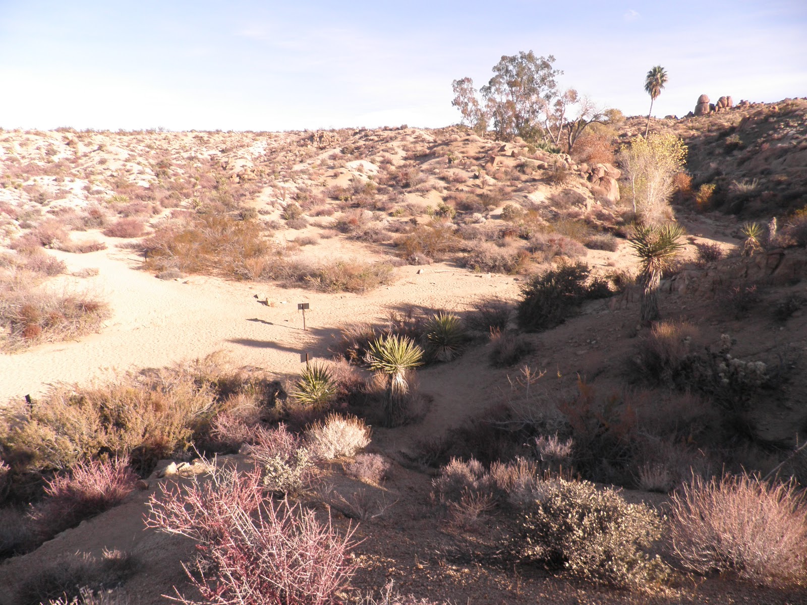
Rain! That is what we had when we left Owl Canyon Campground. It made the washboard road even worse as we made our way to the highway. I drove the CRV behind Bob as we needed to dump tanks before we got on the road to Borrego Springs. After we dumped our tanks at a local plumbing/RV parts store we hooked the CRV to the RV and we were on the road. We retraced our route south to Yucca Valley and then we veered southwest to I-10. Then it was east to Coachella where we decided to spend the night at Spotlight 29 Casino. We decided to stay in the casino lot as we were still an hour away from our destination and it would be dark by 4:30 p.m. Of course, once we parked at the casino, we had to go inside and check out the place. We learned that if you applied for one of their player cards you received $2 off that day's buffet and you received a free buffet within the next month. Bob and I each got a Spotlight Casino card. We didn't get the $2 off buffet--it was prime rib on Thursday, but we saved our coupon to return within the month. The night in the casino parking lot was okay, but it was noisier (next to I-10) than I like and much too bright for sleeping with the number of lights in their parking lot
The next day it was on to Borrego Springs and Anza Borrego Desert State Park, the largest state park in California. Bob had researched the area and knew that we wanted to stay outside Borrego Springs near Peg Leg Road. We just had to keep our eyes open for the RVs parked in the desert along County Road S22. We did make a stop at Red Earth Casino to top off the gas tank in the RV and to fill with fresh water. This is another casino that caters to RVers. They had a free dump, free fresh water and free over night camping. From there it was only about 25 miles to our destination. Once we started seeing RVs in the desert, we found a place to pull off the road and we found a place to set up camp. This area is known for its boondocking (camping without hookups or designated sites). First thing we did was check our Internet and cell phone reception--both good! Then it was time to check television reception--only Mexican channels:( Down went the antenna and down it stayed our entire time at Borrego Springs.
Since we arrived early on Friday, we drove into Borrego Springs to
explore the town and to visit the state park information center. One
place we wanted to visit was the Marshal South homestead on Ghost
Mountain. Marshal South was the pen name of an Australian writer who
wanted to get away from the hectic life in Oceanside, California in the
1930s. He and his wife Tanya moved to the primitive mountain top of
Ghost Mountain. They lived there with their 3 children for 14 years. The
state park offered a guided hike to the mountain top on Saturday
morning. Bob and I were game for that trip.
After our stop at the park, we drove around town and saw the life-size sculptures. There were quite a few and after we got back to the RV, we found out that some had geocaches near them so we would visit them again!
Saturday was a cloudy, chilly morning, but we were determined to make it to Ghost Mountain for the hike at 9:30 a.m. It meant we had to leave our campsite by 8:30 to make sure we arrived on time. It was a nice hike with about 10 people in attendance. The group left the parking area and climbed the mountain for one mile. The Marshal South homestead was on top of a very rocky mountain. The cement bowl in the front of this picture was one of the places the family gathered water.
I am standing in what is left of the doorway to their adobe house.
We were parked in the valley and were glad to get back to the car to get warm. The wind was howling as we came down the mountain.
We wanted to geocache, but it was a little too cold so we continued on up the mountain to the town of Julian. Most of the buildings are on the National Register. Julian is famous for its pies. There are at least 4 shops in town that make apple or pear pies. We tried to get an apple dumpling at Mom's Pies, but they were so crowded, we moved across the street to Apple Alley Pies. I got an apple turnover and Bob chose a cinnamon roll. They would be dessert back at the RV. We ate a late lunch at Julian Coffee Shop. The shop was located at the end of town and due to the cold weather, not many people made it that far down the street. After our trip to Julian it was time to head back to the RV. The days are short and since we are in the eastern part of the Pacific Time Zone, sunset was at 4:30 p.m. We didn't want to be on the road after dark.
Sunday morning we walked around the campground and found some geocaches in the area. Peg Leg Road is named for Peg Leg Smith a famous miner who once lived in the area. I don't know if he was known for his mining or his tall tales.
But for those who like to believe the stories about his mining success, here is a special sign....
...and the pile of rocks people have added to over the years.
Monday we chose to hike Palm Canyon Trail. The hike led 1.5 miles to a palm oasis. We had to cross the stream twice.
One thing we have noticed about the fan palms in the west--no one trims them. The old fronds are supposed to protect the trees from insects.
Here we are looking down on the palms from a rock area not far from the oasis.
It was a good hike and as you can see, the weather was warm enough for us to go without jackets or windbreakers.
Later in the afternoon we decided to do some more geocaching. We couldn't find the cache at the park sign.
But we were able to find the one hidden on this grasshopper. The dog belonged to someone out for a ride and he had to say hello.
Another cache was found on this site where the plaque lets you know nothing happened.
Tuesday we decided to drive toward Warner Springs Resort. There was nothing open at the resort, but we were there to geocache. We drove up Indian Flat Road. There were caches every tenth of a mile all the way to the campground about 7 miles up the mountain. This is a view of the road from almost the top of the mountain.
Once we found the caches, we were hungry, so we went in search of a
place to eat. Warner Springs was closed as were the places at Lake
Henshaw. Our last resort was Santa Ysabel Casino. As luck would have it, when you applied for their player's card you qualified for a free surf and turf dinner. Yes, Bob and I had surf and turf as our late lunch. By the time we got back to the RV, it was dark.
The next day it was geocaching again. This time we searched on the other side of town near the sculptures.
We thought Christopher and DeAnna would like to see these!
Thursday, we went hiking with a new friend we met camping near us. He suggested The Slot. It was a great hike through a slot canyon in the park.
Some of the passageways were pretty narrow.
Once out of the slot we continued on to a different rock formation. The holes in this rock were very smooth. Anza Borrego Desert Park is Butch's favorite park. He took us on some fantastic hikes.
Then it was time to go back through the slot. We all wondered why this rock was still hanging above the slot.It has some serious fractures that go all the way through the rock.
There are so many hikes and places to see around Borrego Springs that we decided to stay at least two weeks. This is the end of our first week!
Thursday, December 27, 2012
Monday, December 17, 2012
Owl Canyon Campground, Barstow, CA
Friday morning we left Belle Campground and headed farther north to Owl Canyon Campground northwest of Barstow, CA. Once we turned on Fossil Bed Road, we began to wonder what we had gotten ourselves into--it was the bumpiest dirt road and we were in the RV, not the car. If Bob went over 5 miles per hour, everything shook until I thought the whole RV would fall apart! Well, about 6 miles later we found the campground and low and behold there was nobody there! We found a nice spot and set up before settling in for the night. Did I mention that it gets dark around 4:30 p.m.?
Right after we settled in for the night we discovered that we had Internet, cell phone, and television! What a pleasure that was! Bob downloaded geocaches for the area so we would be prepared no matter where we traveled.
That night we heard several cars pull into our area and the people began setting up tents in the dark. The next morning we found that we had a boy scout troop camping a ways down from us.
Saturday morning we decided to go for the two caches near the campground. Here is a view of our RV from one of the caches.
The other near by cache was a little higher in the hills.
After that we drove to Rainbow Basin to view the area and find some caches. We could only pull over to get one of the three caches along this one way drive. There were too many other cars traveling the road for us to pull over and climb the rocks without blocking their way. The one we found was difficult to get a good position to get it. Bob ended up flipping rocks off the cache and then flipping the cache down to our level. There had been a bit of a rock slide since it was placed and there was no safe way to get the container. We moved it down the rock wall about 3 feet to make it safer for other cachers.
Later that afternoon we hiked Owl Canyon. At first it was just a dry wash, then it turned into a slot canyon.
We had to scramble up some rocks to reach the end of the trail.
On our way back down the trail, we stopped to look in a cave that the Boy Scouts visited that morning. We knew they had been there because they left their lumi-sticks behind! The red one marks the end of the cave.
Sunday we played tourists and cached our way to Calico Ghost Town.
I took a breather on the front porch of the restaurant.
We enjoyed seeing the old buildings once used by miners and pioneers in the area.
Okay, this is not one of my favorite shots (of me), but the house was interesting. It is made from old soda bottles.
This building used the mountain as its back wall.
On our way back to our camp site we stopped at Peggy Sue's Diner on what used to be Old Route 66. There was even a geocache located behind the diner. All in prep for our next 2 record setting days of geocaching!
Monday we set off to break our record of 80 caches in one day and we did it! We found 100 caches! It was a long day, but we were up for the challenge. Tuesday, we decided to try to break our new record and yes, we beat 100 caches--we found 142 caches! It was a lot of driving down dirt roads, but we did it! Unfortunately, we didn't find all the caches in the area. We could easily have done another day of over 100 caches!
Wednesday we drove around Barstow, mailed some Christmas cards, and did a little shopping. Thursday would be moving day!
Right after we settled in for the night we discovered that we had Internet, cell phone, and television! What a pleasure that was! Bob downloaded geocaches for the area so we would be prepared no matter where we traveled.
That night we heard several cars pull into our area and the people began setting up tents in the dark. The next morning we found that we had a boy scout troop camping a ways down from us.
Saturday morning we decided to go for the two caches near the campground. Here is a view of our RV from one of the caches.
The other near by cache was a little higher in the hills.
After that we drove to Rainbow Basin to view the area and find some caches. We could only pull over to get one of the three caches along this one way drive. There were too many other cars traveling the road for us to pull over and climb the rocks without blocking their way. The one we found was difficult to get a good position to get it. Bob ended up flipping rocks off the cache and then flipping the cache down to our level. There had been a bit of a rock slide since it was placed and there was no safe way to get the container. We moved it down the rock wall about 3 feet to make it safer for other cachers.
Later that afternoon we hiked Owl Canyon. At first it was just a dry wash, then it turned into a slot canyon.
We had to scramble up some rocks to reach the end of the trail.
On our way back down the trail, we stopped to look in a cave that the Boy Scouts visited that morning. We knew they had been there because they left their lumi-sticks behind! The red one marks the end of the cave.
Sunday we played tourists and cached our way to Calico Ghost Town.
I took a breather on the front porch of the restaurant.
We enjoyed seeing the old buildings once used by miners and pioneers in the area.
Okay, this is not one of my favorite shots (of me), but the house was interesting. It is made from old soda bottles.
This building used the mountain as its back wall.
On our way back to our camp site we stopped at Peggy Sue's Diner on what used to be Old Route 66. There was even a geocache located behind the diner. All in prep for our next 2 record setting days of geocaching!
Monday we set off to break our record of 80 caches in one day and we did it! We found 100 caches! It was a long day, but we were up for the challenge. Tuesday, we decided to try to break our new record and yes, we beat 100 caches--we found 142 caches! It was a lot of driving down dirt roads, but we did it! Unfortunately, we didn't find all the caches in the area. We could easily have done another day of over 100 caches!
Wednesday we drove around Barstow, mailed some Christmas cards, and did a little shopping. Thursday would be moving day!
Thursday, December 13, 2012
Joshua Tree National Park--Belle Campground
The drive to Belle Campground was just a short one and we were set up in
no time. Our site was next to some big rocks. It reminded us of City of
Rocks State Park in NM.We just wished it had TV, Internet and cell phone coverage. Oh, well, we were still in the wilderness.
Our first night at Belle, we had a beautiful sunset with a Joshua tree silhouetted
The next day we chose three short hikes in different areas. The first was Skull Rock Trail near Jumbo Rocks Campground.
The skull kept calling to me saying it had an itchy nose. So I went over and gave it a scratch.
Our next trail was Barker Dam Trail. This dam was used to collect water for the cattle that once grazed in the area.
We finished our day of trails with Hidden Valley. We didn't take a lot of pictures since it was the most crowded trail we hiked that day.
The next day we returned to Barker Dam Trailhead, but took the Wall Street Mill Trailhead. Our first stop was the windmill that used to help pump the water.
This stone marked the place where W. E. Keys killed a man. Keys served 5 years and then returned to the area.
This is Wall Street Mill. It was where gold was separated from ore. Bob and I thought we should be wearing HAZMAT suits since mercury was used in the process. The ore was mixed with water and mercury, then crushed in the stamp mill. Then the mixture passed over plates coated with mercury so the gold would adhere to the mercury.
There were many old trucks in the vicinity of the mill. Most still had remnants of their tires. This truck was scary--the driver sat over the gas tank!
Near the abandoned house was an area hidden by trees. The bricks were used to close the entrance and the resulting 'cave' was used as a refrigerator for perishables.
Later in the afternoon we went to White Tank Campground to see the largest arch in Joshua Tree NP. It was really rather small.
I thought this rock was going to fall so I had Bob hold it up.
Here is one of the formations that caught our eye.
The next day we were moving north to a campground near Barstow, California. We could only hope it would have Internet, TV, and cell coverage.
Wednesday, December 12, 2012
Joshua Tree National Park--Cottonwood Campground
From Salton Sea to the southern entrance to Joshua Tree National Park is not far, only about 45 miles going to Indio and then taking I-10 east to the Joshua Tree exit.
We thought about taking Box Canyon Road between Mecca Hills Wilderness Area and Orocopia Wilderness Area, but out west the roads are not always paved into wilderness areas. The drive only took about an hour and a half. We had a long uphill climb on I-10 east of Indio. Once we were set up, Bob wanted to watch the Georgia/Alabama game, but alas, we had not TV reception, no Internet and no cell phone.
So we got in the car and headed north to 29 Palms. Turns out it is probably the only small town we have visited that did not have a sports bar. I finally tuned the radio to an AM station that was broadcasting the game and we drove back to our campground . Once in the RV, Bob tuned the RV radio to the AM station and continued to cheer for Georgia. Unfortunately, he couldn't hear the end of the game--reception went to static and he didn't find out until Sunday how the game ended.
Sunday we decided to go geocaching along Box Canyon Road just to check it out for future travels. Turns out it is paved all the way and as it goes through the canyon, there was no elevation change. We could have saved 20 miles by taking Box Canyon Road...now we know!
Monday it was time to hike some trails. There were 2 trails near Cottonwood Campground that we wanted to hike. We chose to hike Mastodon Peak Loop (3miles) since it had been a while since we had done serious hiking. Along the way we stopped at an abandoned mine and tried to guess how everything looked when it was a thriving enterprise.
Above the mine was Mastodon Peak.
Of course no desert hike is complete without cholla. The spikes on this one look like plastic needles. I am pleased to say that neither of us got stuck on this hike.
We had a great view of Salton Sea and the surrounding area.
We enjoyed the Mastodon Peak Loop trail.
Last sight on the trail was Cottonwood Springs. There was no water, but during the spring and summer it is more of an oasis than it was when we saw it. It still had California Fan Palms that looked out of place in the desert.
Tuesday we hiked the much longer hike to Lost Palms Oasis. We hiked through several slot canyons...
... and across many ridges.
At the end of the trail was an overlook of the palm oasis.
We decided that since we had walked all that way (3.2 miles) we should continue down to the oasis.
There were pools of water at the base of several palms.
We took a thirty minute break before climbing out of the oasis area.
It was a great hike, one of our favorite on this trip.
Wednesday we went geocaching outside the southern entrance of the park. A series of caches was in an area where troops trained with Patton in WWII.
There was also a museum dedicated to Gen. Patton.
Bob went in this big barrel to get one of the caches.
After geocaching, it was time to move to Belle Campground about 28 miles north of Cottonwood Campground. We would spend the rest of our time at Joshua Tree in the northern area of the park.
We thought about taking Box Canyon Road between Mecca Hills Wilderness Area and Orocopia Wilderness Area, but out west the roads are not always paved into wilderness areas. The drive only took about an hour and a half. We had a long uphill climb on I-10 east of Indio. Once we were set up, Bob wanted to watch the Georgia/Alabama game, but alas, we had not TV reception, no Internet and no cell phone.
So we got in the car and headed north to 29 Palms. Turns out it is probably the only small town we have visited that did not have a sports bar. I finally tuned the radio to an AM station that was broadcasting the game and we drove back to our campground . Once in the RV, Bob tuned the RV radio to the AM station and continued to cheer for Georgia. Unfortunately, he couldn't hear the end of the game--reception went to static and he didn't find out until Sunday how the game ended.
Sunday we decided to go geocaching along Box Canyon Road just to check it out for future travels. Turns out it is paved all the way and as it goes through the canyon, there was no elevation change. We could have saved 20 miles by taking Box Canyon Road...now we know!
Monday it was time to hike some trails. There were 2 trails near Cottonwood Campground that we wanted to hike. We chose to hike Mastodon Peak Loop (3miles) since it had been a while since we had done serious hiking. Along the way we stopped at an abandoned mine and tried to guess how everything looked when it was a thriving enterprise.
Above the mine was Mastodon Peak.
Of course no desert hike is complete without cholla. The spikes on this one look like plastic needles. I am pleased to say that neither of us got stuck on this hike.
We had a great view of Salton Sea and the surrounding area.
We enjoyed the Mastodon Peak Loop trail.
Last sight on the trail was Cottonwood Springs. There was no water, but during the spring and summer it is more of an oasis than it was when we saw it. It still had California Fan Palms that looked out of place in the desert.
Tuesday we hiked the much longer hike to Lost Palms Oasis. We hiked through several slot canyons...
... and across many ridges.
At the end of the trail was an overlook of the palm oasis.
We decided that since we had walked all that way (3.2 miles) we should continue down to the oasis.
There were pools of water at the base of several palms.
We took a thirty minute break before climbing out of the oasis area.
It was a great hike, one of our favorite on this trip.
Wednesday we went geocaching outside the southern entrance of the park. A series of caches was in an area where troops trained with Patton in WWII.
There was also a museum dedicated to Gen. Patton.
Bob went in this big barrel to get one of the caches.
After geocaching, it was time to move to Belle Campground about 28 miles north of Cottonwood Campground. We would spend the rest of our time at Joshua Tree in the northern area of the park.
Subscribe to:
Posts (Atom)