 We used McChord AFB as our base to explore the area. One day we took a trip to Mt. Rainier. We did a few geocaches along the way.
 Another place was Elbe Sculpture Garden. We would have missed it completely if we hadn't been geocaching! It reminded us of the place near Paula's that she took us to years ago.
 We finally got to Mt. Rainier National Park. It would be a great park if someone would re-engineer the parking areas!
 We drove to Longmire, the first ranger/visitor station and it was packed! No parking anywhere, so we continued on to Paradise. What a mess! They are constructing a new visitor center so most of the parking area is blocked. There was an area along a 2 mile loop road that was marked for parallel parking. Problem was if you parked there, it was quite a hike up the hill to the current visitor center. We saw signs for a shuttle, but never saw one!
We parked in the day use/picnic area and walked to the visitor center. It was a bit disappointing as the power was out! We heard a generator running, but that was for the cash register, not to run the movie or light the exhibits. As we stepped out of the center, we had a good view of Mt. Rainier. We found a map and walked Nisqually Vista Trail. It was a 1.2 mile loop trail that had views of the Mt. Rainier, waterfalls, glaciers, and wildflowers. There were also some signs we needed to read to claim a geocache. Mt. Rainier was behind us in this picture, but the clouds had already moved into the area.
 If you look closely you may see a waterfall on the right and one on the left. Both feed the Nisqually River in the gorge below.
 Even though it was the second week of August, there was still snow on the trail. Many of the backcountry trails were still impassable due to snow.
 After hiking Nisqually, we drove back toward Longmire. We stopped at Narada Falls picnic area to eat our lunch and check out the falls.
 Our next stop was Carter Falls Trail. This was one of those trails that goes uphill until time to turn around and come back down--and a steep uphill it was!
 About 200 yards beyond Carter Falls was Madcap Falls, but it was not marked on the trail signs! We could see it much better than Carter Falls.
 When we returned to Carter Falls, we found a short trail off the main trail that gave a better view of the falls. No, we didn't lean on the railing.
 We rested a few minutes then headed back down to the car. This trail had an interesting bridge for us to cross to get from the parking area to the main trail. It was just a few feet over the water and bouncy!
 We returned to Elbe to get a cache that was crowded when we first went near it. Elbe also had an interesting motel---cabooses on the railroad tracks. The dining car was a pizza restaurant.
The rest of our time at McChord we spent geocaching the nearby area, defrosting the refrigerator, restocking the pantry, and enjoying the campground. We decided not to visit Seattle because of TRAFFIC! It was the worst we had seen since we lived outside of Washington D.C. Even in the middle of the day traffic crawled along bumper to bumper on the interstate. Side roads were just as bad. We made it to the Tacoma Dome to see an rv show, Fife to visit the Honda dealer (for touch-up paint to hide a rock chip on hood) and Camping World. Other than that we stayed close to Ft. Lewis and McChord AFB.
Most of our trip we have been following record breaking cold or snow. Now we are in a record breaking heat wave. It was in the mid 90s at McChord. Seattle broke several records.
After leaving McChord on Sunday, August 17, we headed toward Spokane. The drive was eerily similar to our drive through west Texas. Only the temperature was over 100 degrees during this drive!

We checked into the fam-camp at Fairchild AFB and plan to stay until the heat subsides (Tuesday or Wednesday). Our plan (if we have one) is to head to Glacier National Park.

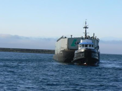 The ferry had to wait for several float planes to land. The planes land, then taxi to the docks to let passengers disembark.
 Once we cleared customs, we headed for the tourist information center to purchase bus passes for the day. The agent sold us our passes and gave us directions to the place we needed to be to meet the bus going to Butchart Gardens. We walked the few blocks to the stop and had about 15 minutes before our bus arrived. We looked in the stores near the stop then helped some other tourists with the bus schedule to the gardens. Our bus was right on time and we enjoyed viewing Victoria for the hour it took to get to the gardens. We were glad we didn't drive as there was a lot of construction with many detours.
 The gardens were built on an old limestone quarry. The sunken gardens were sodded and planted in the early 1900s. It was and still is owned by the Butchart family. Jennie Butchart had a vision of beautiful gardens and was able to hire professionals to help her achieve that goal.
 In addition to the sunken garden, there are a rose garden.....
 ....Japanese garden....
 ...Italian garden.....
 ,,,and garden areas to transition between them. We had a good view of the house from Three Sturgeons Fountain.
 There area several areas where you could retreat and enjoy the surrounding area and people watch. There were many tourists from all over the world.
 The gardens need continual care. We saw people dead-heading flowers throughout the park. In a nook near the rose garden we saw a truck with all the dead-heads.


 Wednesday we drove west to Cape Flattery. We did a few geocaches along the way. Cape Flattery is located on the Makah Reservation. To visit the reservation you have to have a $10 permit, but it is good for the calendar year. The road to the trailhead took us past and old Air Force Station which now houses the tribal council.
 At several places along the trail you could stop and view the ocean on either side of the cape.


 From the memorial we went to the Makah Museum. One of our geocaches was located on the totem pole outside the museum.
 Inside the museum there were many artifacts from the Ozette Dig of the 1970s. Ozette was buried by a mudslide over 500 years ago. In the 1970s, the ocean uncovered some of Ozette. The items were recovered and are now housed in the museum.
  You can barely make out British Columbia through the fog behind us.


 Monday we went sightseeing. Our first stop was at a big cedar tree. The tree is no longer living, but the top has many other trees growing from it!
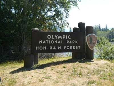 There were two trails that meandered through the rainforest. The first took us over Taft Creek. The water was so clear you couldn't tell what was underwater and what wasn't! The moss hanging from the tree was out of the water, everything else was underwater!
 We hiked the Rainforest Trail and had to walk between these two downed trees!
