Ahh, back in the lower 48! Malmstrom AFB, here we come. I hope there are sites available. Yes, there were plenty of sites. And, the Internet provided by the campground worked great! Bob and I got the RV parked and we settled in to spend a week resting and exploring Great Falls. We would also take both vehicles in for check-ups and oil changes. Our first day we spent geocaching. These Canada geese guard the entrance to the USDA office in Great Falls.
We found caches near each of the falls the week we were there. Great Falls was a big stop for Lewis and Clark in their search for a northwest passage.
The next day we visited First People's Buffalo Jump about 20 miles south of Great Falls.
This is the side of the mesa where the buffalo were herded over to their deaths. It is always interesting seeing the history of a place. There are several buffalo jumps in the northwest, but this is the first one we've seen in Montana.
After visiting the buffalo jump, we went to find the local Sam's store to get a few things they carry that we needed--pretzels! Then it was back to the RV to settle in for the night and do the ever popular laundry.
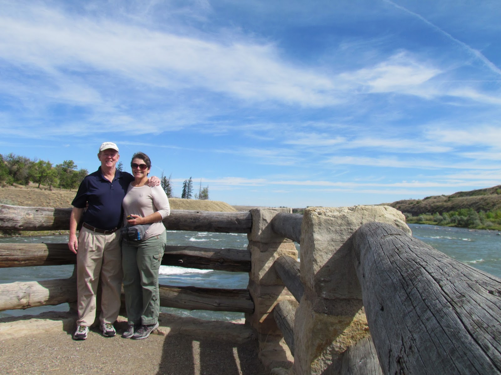
Bob and I decided we needed to get some steps so we chose to hike the trail next to the north side of the river. Our first stop was next to Black Eagle Falls.
It is the fifth waterfall that Lewis and
Clark had to portage around on the Missouri River. Today there are dams
in the river, but they do not interfere with the falls. The water drops
476 feet over a 14 mile stretch of the Missouri River. The dams were
built to divert the water to hydroelectric plants beside each fall. At Black Eagle Falls there is an island in the river below the falls.
We met a local there who told us the best fall was at Ryan Dam. The name of the fall---The Great Falls. After walking to the east end of the island, we headed out of town to find Ryan Dam.
After driving on a narrow two lane road for 9 miles, we arrived at Ryan Dam. Much to our chagrin, Ryan Island closed on Labor Day--we were there on Tuesday after Labor Day. Unless you go out on the island you don't get a good view of the falls. While at the dam, we met another camper from Florida who had also just returned from Alaska. We talked for quite a while. Then another car drove up with a lot of locals--we were all disappointed the island was closed. So if you ever want to visit Ryan Island to view the falls, be sure to arrive between Mother's Day and Labor Day.
Bob and I spent so much time talking to the Floridian at Ryan Dam that we didn't have time to hike or geocache in the area. We needed to head back and get some lunch. The following day we went back to Ryan Dam and found North Shore Trail just before the residential area for the dam workers. We walked the loop and found quite a few geocaches. Then we got in the car and drove to Morony Dam,
3 miles further down the road. There we hiked Sulphur Spring trail.
The trail followed the river for the most part. We watched these Canada geese enjoying the river.
We found a few geocaches on this trail, too.
Sulphur Spring was at the far end of the loop. This is the spring where Lewis and Clark sent their men to fill containers with water for an ailing Sacajawea. It is reported that after drinking water from this spring that she recovered from a serious illness.
Across the Missouri River from Sulphur Spring was Portage Creek. Lewis and Clark hiked two miles up the creek to find a place where the cliffs weren't so steep to get the canoes and supplies out of the river to portage around the falls.
We searched for a cache near the spring, but all we got were burrs all over our clothes.
Enough of looking for that elusive cache, we had a long way to go to get back to our car and it was hot! We had plenty of water, but the sun was shining on us from a very clear sky--something we weren't used to after being in the far north for three months.
We went back to the RV and rested for the evening.And lo and behold, we finally got to see a fantastic sunset!
What a great ending to our visit to Great Falls, Montana.


3 comments:
Beautiful sunset picture. So glad you finally had some great weather!
I am trying to get in contact with Bob & Joyce. I am very interested in seeing all your camping spots on your trips. I want to look at them on Google Earth. I cannot figure out what format you are using for your GPS coordinates. I cannot get your coordinates to work on any of the Lat/Long choices on Google Earth.
Connie if this went to you, I apologize. I cannot find any way to contact Bob & Joyce on their site, "Where in the USA RV". If you did get this, please forward it to Bob & Joyce or let me know how I can communicate with them.
Thanks,
Harold
Harold,
We are sorry you are having trouble with the coordinates. We are recording them from a DeLorme GPS and they are the same format used by our Garmin GPS.
Post a Comment